
By Clint Alley
Lawrence County’s Changing Borders
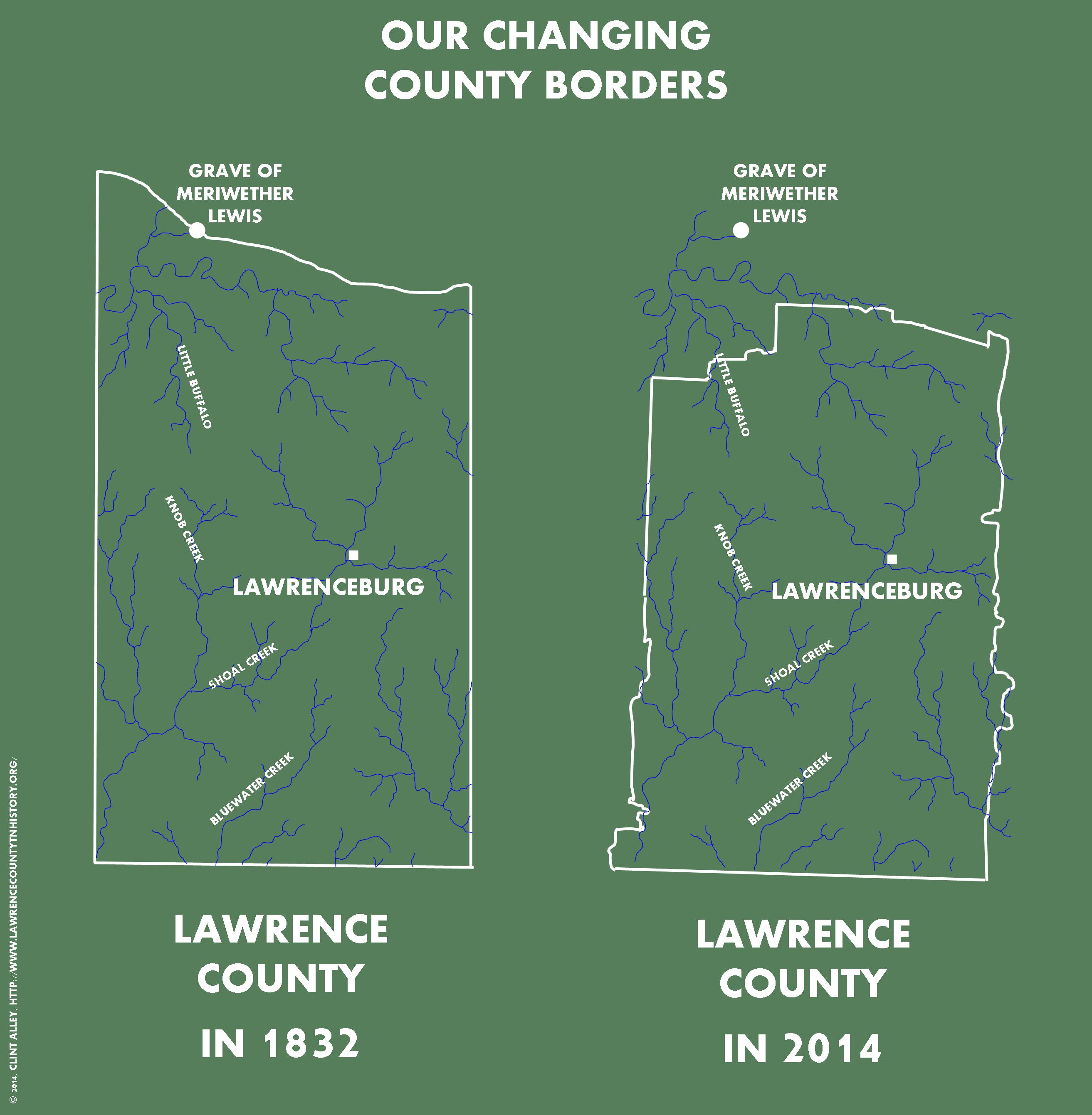
At left is a reproduction of Lawrence County’s boundaries as found in Matthew Rhea’s 1832 map of Tennessee. At right is modern Lawrence County, with the Rhea waterways overlaid for comparison. Infographic created by Clint Alley.
You may have seen ‘How the States Got Their Shapes,’ but have you ever thought about how our county got its unique shape? And did you know that Lawrence used to share a border with Hickman County?
At the left is a reproduction of the map made of Lawrence County by Matthew Rhea in 1832, notable for its attention to detail in the county’s waterways. At the right are the modern borders of Lawrence County. For comparison, I have overlaid the waterways from Rhea’s 1832 map on the modern county borders, despite the fact that several of the streams may have since changed or slightly deviated their courses. But the city of Lawrenceburg and the grave of Meriwether Lewis have not moved in the 182 years since Rhea’s map was drawn.
Lewis County
The most dramatic alteration in the county’s original boundaries was the creation of Lewis County in 1843. It was formed from parts of Perry, Hickman, Lawrence, Maury and Wayne counties.[1] The grave of famed explorer Meriwether Lewis (of ‘Lewis and Clark Expedition’ fame) was located at one time on Lawrence County’s northern border. Today it is several miles inside Lewis County. The explorer met his end at nearby Grinder’s Stand on October 11, 1809 of suspected suicide–although the debate about his cause of death rages on among historians to this day.[2]
Private Acts
Changes in the original ramrod-straight east and west borders of Lawrence County are attributed, in part, to dozens of private acts of the Tennessee Legislature over the almost two centuries of Lawrence County’s existence. To avoid paying property taxes in two different counties, landowners who lived on the county line often petitioned the state government to include their lands wholly in one county or another. On the rare occasions that these requests were granted, it changed the boundaries of the entire county, giving us the crooks and crannies that we see on the modern map.[3]
Caution to Genealogists
Shifting boundaries are especially important for genealogists to remember. If you find an ancestor who seems to have jumped the county line, remember that the county line may well have jumped them, instead.
Sources
FamilySearch, “Lewis County, Tennessee.” Last modified Feb 13, 2014. Accessed March 26, 2014. https://familysearch.org/learn/wiki/en/Lewis_County,_Tennessee.
Lawrence County, Tennessee Census Records: 1820, 1830 & 1840 and Miscellaneous Early County Records. Edited by Shirley Hollis Rice.
National Park Service, “Natchez Trace: Meriwether Lewis.” Accessed March 26, 2014. http://www.nps.gov/natr/historyculture/meriwether-lewis.htm.
—
[1] FamilySearch, “Lewis County, Tennessee.” Last modified Feb 13, 2014. Accessed March 26, 2014. https://familysearch.org/learn/wiki/en/Lewis_County,_Tennessee.
[2] National Park Service, “Natchez Trace: Meriwether Lewis.” Accessed March 26, 2014. http://www.nps.gov/natr/historyculture/meriwether-lewis.htm.
[3] Lawrence County, Tennessee Census Records: 1820, 1830 & 1840 and Miscellaneous Early County Records, ed. Shirley Hollis Rice , 89-105.

Pingback: Bringing Local History to the Classroom | Lawrence County History Trivia