The following tool is intended for the use of local teachers and students. I have aligned the state social studies standards with articles I have written pertaining to a similar topic in Lawrence County history. It is my great desire to see the information I have shared here help students engage in local history as well as in their schoolwork. Some of the standards do not have any Lawrence County-specific connections. I will add to this list as I publish more local history research.
TN.01
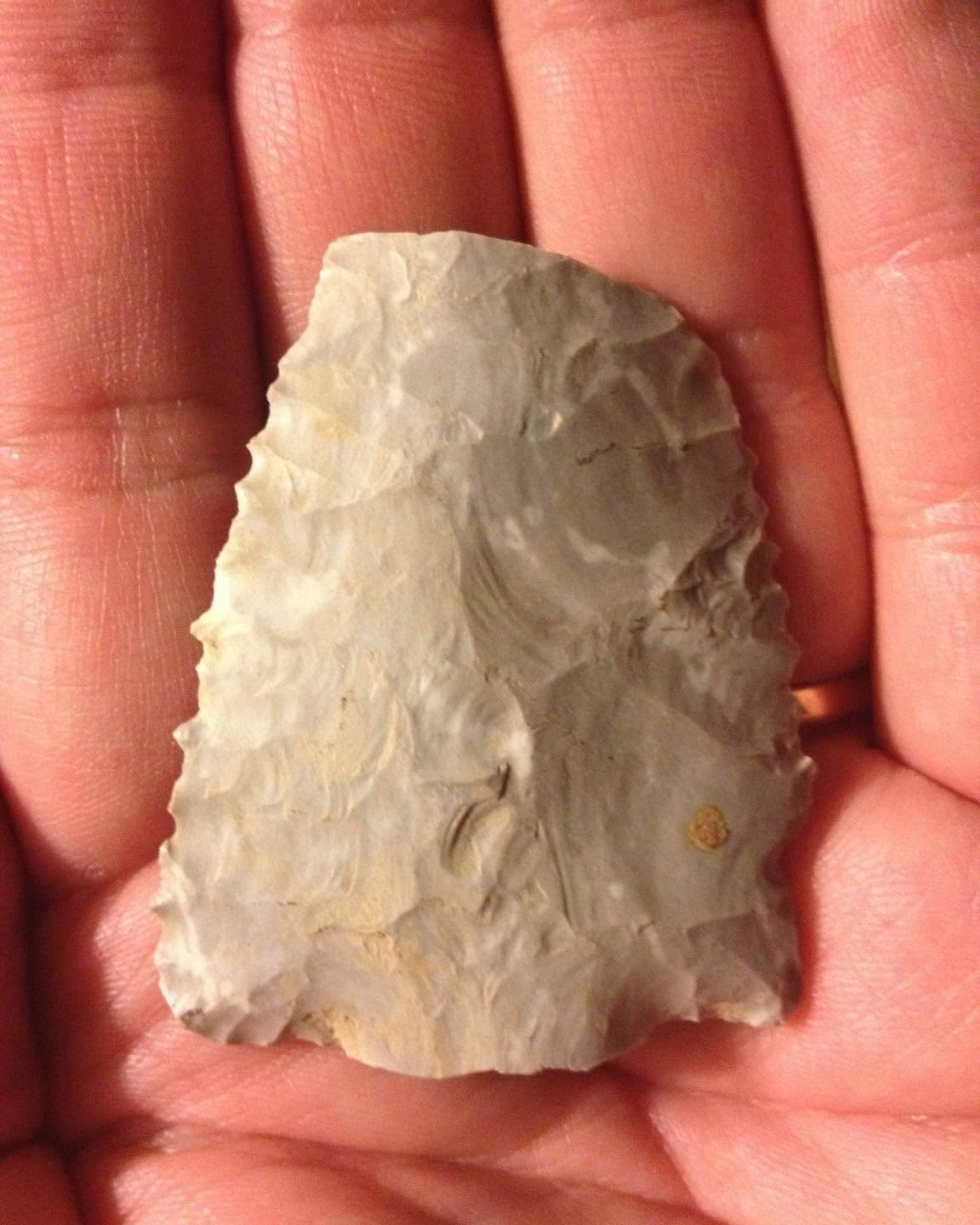
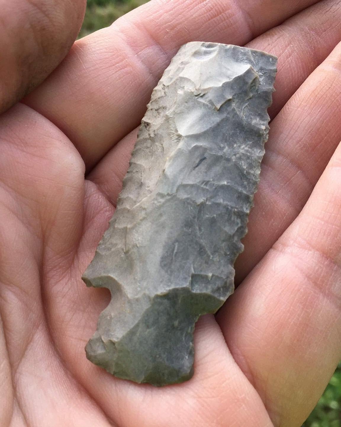
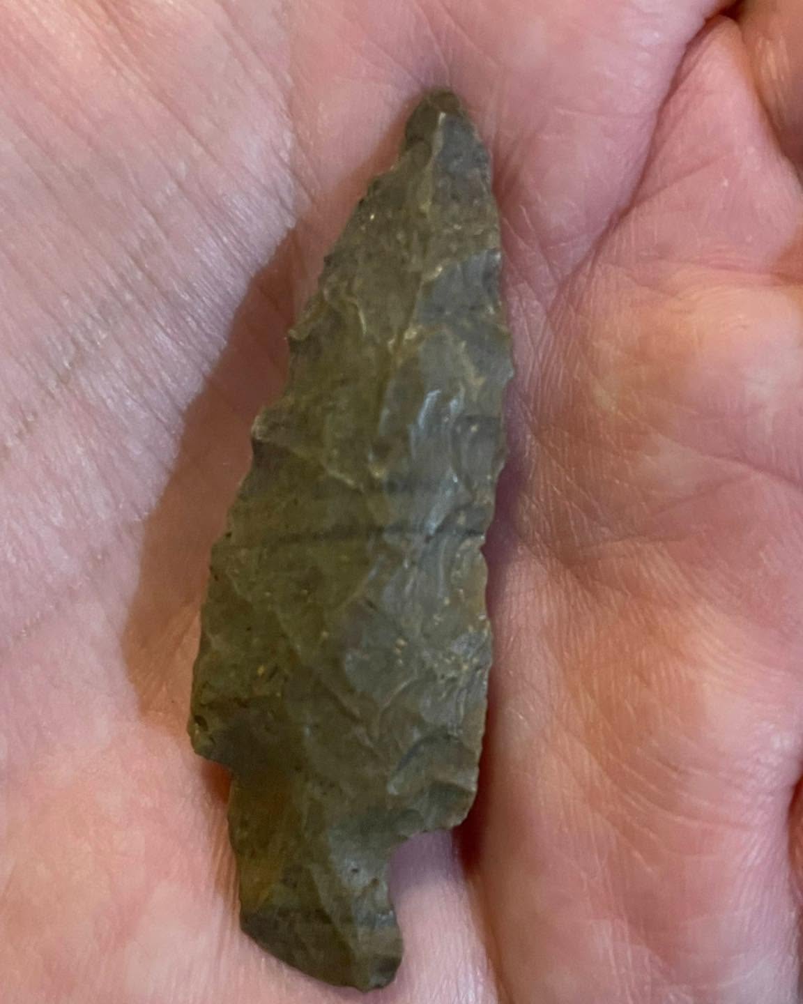
Describe changes in life in the Tennessee region from the late ice age through the Archaic period.
The Lost Reef
The Shumate Giant Comes to Lawrenceburg
TN.02
Compare and contrast features of life in the Tennessee region during the Woodland and Mississippian periods.
The Excavation of the Danely Mound
Ancient Treasures
Marcella Falls: A Brief History
TN.03
Analyze the customs and traditions of American Indians located in the Tennessee region prior to European contact, including: • Cherokee • Iroquois • Chickasaw • Shawnee • Creek
When Shoal Creek Was Called Indian Creek
The Secret in the Cave Just West of Lawrenceburg
TN.03
Analyze the customs and traditions of American Indians located in the Tennessee region prior to European contact, including: • Cherokee • Iroquois • Chickasaw • Shawnee • Creek
When Shoal Creek Was Called Indian Creek
The Secret in the Cave Just West of Lawrenceburg
TN.04
Describe the impact of European exploration in the Tennessee region, including the significance of Christopher Columbus, Hernando de Soto, and Juan Pardo.
TN.05
Describe the influx of British and French settlers and fur traders in the Tennessee region and their impact on American Indian tribes.
The Legend of Granddaddy Creek
TN.06
Explain the contest between the British, the French, and American Indians for land in the Tennessee region prior to the French and Indian War
TN.07
Describe the effects of migration into the Tennessee region, including the development of the Watauga and Cumberland Settlements.
When Shoal Creek Was Called Indian Creek
TN.08
Identify episodes of fighting that occurred in the Tennessee region during the American Revolution (e.g., Battle of Kings Mountain) and the effects of American victory on the area.
Lawrence County’s Last Revolutionary Soldier
Paid in Full: Lawrenceburg Innkeeper Shows Respect to Revolutionary Veteran
TN.09
Identify reasons for the foundation and failure of the independent state of Franklin in 1784.
TN.10
Analyze the effects of land speculation on settlement in the Territory South of the River Ohio (i.e., the Southwest Territory).
The Man Who Owned Three Square Miles of Lawrence County
TN.11
Analyze the conflicts between early Tennessee settlers and American Indians.
The Intruders on Shoal Creek
The Chickasaw Cession of Lawrence County
The Unclaimed Land Grant that Became Lawrenceburg
TN.11
Analyze the conflicts between early Tennessee settlers and American Indians.
The Intruders on Shoal Creek
The Chickasaw Cession of Lawrence County
The Unclaimed Land Grant that Became Lawrenceburg
TN.12
Describe the events and trace the process of Tennessee achieving statehood in 1796.
TN.13
Describe major features of the Tennessee Constitution of 1796. (T.C.A. §49-6-1028)
TN.14
Analyze the growth of Middle Tennessee in the early 1800s in power and influence, including the relocation of the capital.
Lawrence County’s First Government
TN.15
Describe the distribution of slaves between the three grand divisions of Tennessee, the lives of free blacks and slaves, and the role of Tennesseans in the early abolition movement (e.g., Elihu Embree).
A Snapshot of Slavery in Lawrence County, Tennessee
TN.16
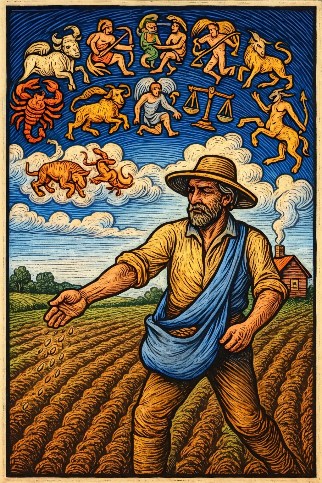
Describe aspects of farm life, work, religion, and community for families in early Tennessee.
Venison, Anyone?
When To Plant: Some Agricultural Folk Wisdom
The Pioneers of Pleasant Garden
Fields of Faith at Mt. Ararat
Crime on the Wild Frontier
TN.17
Describe the economy of Tennessee in the early 19th century.
Napier Iron Works
The Wild Frontier: The 1820 Census in Lawrence County
TN.18
Describe the New Madrid Earthquakes of 1811-12 and the resulting effects on the land and culture of Tennessee.
TN.19
Describe Tennessee’s involvement in the War of 1812 (e.g., Tennessee volunteers, Felix Grundy, Andrew Jackson), and analyze the role of American Indians during the war.
These Veterans of 1812 Were Still Living in Lawrence County 70 Years Later
When the President Came to Lawrenceburg
The General Richard Allen Home of Ethridge
TN.20
Describe the significance of the Mississippi River, the Jackson Purchase, and the introduction of cotton in the rapid growth of Memphis and West Tennessee.
The Man Who Owned Three Square Miles of Lawrence County
TN.21
Explain the importance of transportation, technology, and geography in Tennessee’s growing involvement in the national economy after the War of 1812, including the significance of: • Cash crops (e.g., cotton, tobacco) • Natchez Trace • Road improvements • Steamboats
How the County Got Its Shape
The New Jackson Highway Goes East
A Brief History of the Central Turnpike
The Lost Stand of Alexander Springs
A Traffic Jam in Downtown Lawrenceburg
The Lost Village of Laurel Hill
TN.22
Describe the contributions of Presidents Andrew Jackson and James K. Polk to Tennessee and American history.
When the President Came to Lawrenceburg
A Presidential Barbecue: Lawrenceburg’s Celebration of James K. Polk
The Lawrenceburg Postmaster Who Was Fired by the President
TN.23
Describe the impact of the Indian Removal Act and the Trail of Tears on Tennessee.
The Trail of Tears in Lawrence County
TN.24
Discuss the contributions of important figures during Tennessee’s “golden age,” including: • John Bell • David Crockett • James C. Jones • Newton Cannon • Ephraim Foster • Sequoyah • William Carroll • Sam Houston • Hugh Lawson White
Lawrence County’s First Government
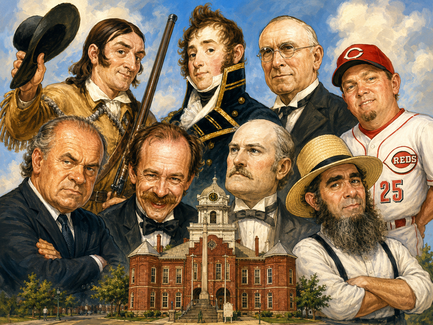
Three Reasons Why Lawrenceburg is Right to be Obsessed with David Crockett
Remembering David Crockett
David Crockett’s Debt
When David Crockett Became Colonel Crockett
Happy Birthday, Colonel Crockett!
That Time David Crockett Killed 105 Bears in One Winter
The Destruction of Crockett’s Mill
The Dedication of Lawrenceburg’s David Crockett Statue
How Lawrenceburg’s Location Was Chosen
David Crockett Falls in Love
TN.25
Identify the significance of the Tennessee Constitution of 1834. (T.C.A. §49-6-1028)
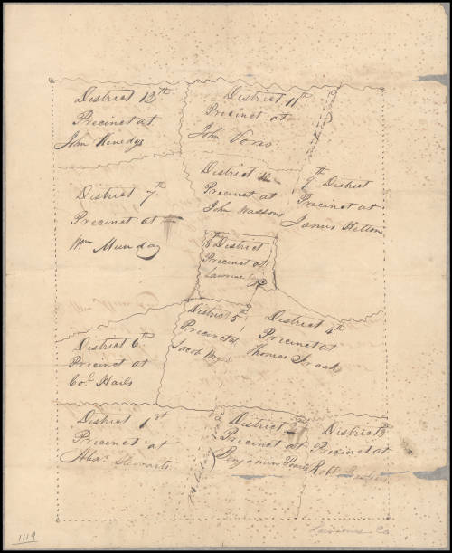
Lawrence County’s First Civil Districts
TN.26
Describe the development of slavery in Tennessee from 1800 to 1860, including the distribution of slaves and conflicting attitudes among the three grand divisions.
A Snapshot of Slavery in Lawrence County, Tennessee
TN.27
Discuss the importance of the Nashoba Community and Free Hill as settlements for freed slaves.
William Hicks and the Struggles of Lawrence County’s Free People of Color
TN.28
Explain the causes of the Civil War and how geographic and political divisions impacted Tennessee’s secession.
When Lawrence County Voted to Leave the United States
Caleb Davis: A Unionist Black Sheep in Civil War Lawrenceburg
Jeff Davis is Coming For Your Guns?
TN.29
Describe Tennessee’s role in the Civil War, including: • Sieges of Fort Henry and • Chattanooga Campaign Fort Donelson • Johnsonville Campaign • Battle of Shiloh • Battle of Franklin • Battle of Stones River • Battle of Nashville
The Great Lawrenceburg Bacon Raid of 1862
The Tragic Death of William Rowland
Billy Pierce: Lawrence County’s Little Giant
A Different Kind of Rebel Flag
A Yankee Spy in Lawrenceburg
The Battle of Lawrenceburg
The Army of Tennessee Moves North: How Hood Road Got Its Name
Veterans’ Accounts of the Battle of Sugar Creek
The Army of Tennessee in Western Lawrence County: A Veteran’s Account
The Bombardment of Lawrenceburg
The Nashville Campaign Comes to Lawrence County
Fightin’ Joe Fights in Lawrence County
The Re-Establishing: Lawrence County’s Wartime Unionist Government
The Execution of Andrew Blakemore
Lawrenceburg’s Mysterious Cannonball
The Daring Escape of John Bell Hollis
TN.30
Identify the contributions of Tennesseans during the Civil War, including: • Sam Davis • Isham Harris • William Driver • Andrew Johnson • David Farragut • Sam Watkins • Nathan Bedford Forrest
In His Own Words: Forrest in Western Lawrence County
Ambush in the Fog: The Fight at Sugar Creek
Andrew Johnson Hits the Campaign Trail in Lawrenceburg
TN.31
Describe how the Civil War impacted various populations in Tennessee (e.g., African Americans, American Indians, and women).
Lawrence County and the Vote to Abolish Slavery
The Fearsome Rolling Pin of Sarah Dearing Kimbrough
The Judgment at Gipson’s Spring
A New Birth of Freedom: Lawrence County’s USCT Soldiers
The Military Career of Corporal Silas Smith, USCT
TN.32
Explain William Brownlow’s role in the development of Reconstruction.
When Lawrenceburg Voted at Bayonet-Point
TN.33
Discuss the impeachment of President Andrew Johnson and its impact both nationally and in Tennessee.
TN.34
Describe the rise, influence, and opposition of the Ku Klux Klan in Tennessee.
Raash Sowell: The Freed Slave Who Wasn’t Afraid of the Klan
When the Klan Showed Up at Cumberland Presbyterian Church
A Racist Spectacle: The Unplanned Klan Rally of 1990
The Death of John Bicknell
When a Founding Klansman Killed a Former Confederate Spy in the Street in Lawrenceburg
Klan Violence in Lawrence County
TN.35
Explain the development and efforts of the Freedmen’s Bureau schools, including Fisk University.
Caleb Davis: A Unionist Black Sheep in Civil War Lawrenceburg
TN.36
Identify early elected black lawmakers and leaders in Tennessee (e.g., Sampson Keeble and William Yardley), and determine their significance.
TN.37
Explain the development of the 1870 Tennessee Constitution. (T.C.A. § 49-6-1028)
The Life of Captain Deavenport
TN.38
Identify exodusters (e.g., Benjamin “Pap” Singleton), and describe their experiences.
Lawrence County’s First Century: A Story in Numbers
TN.39
Explain developments in Tennessee’s farming during the late 19th century as a result of industrialization.
The First Tractor in Lawrence County
The Origins of the Middle Tennessee District Fair
The Alabama Migration to Lawrence County
TN.40
Describe the social, economic, and political changes to Tennessee in the postReconstruction era, and identify the laws put in place to exclude black lawmakers by 1890.
What’s in a Name? Lawrence County’s German Catholic Heritage
The Excavation of Holy Trinity Cemetery
St. Mary’s Cemetery: A National Register Property
An Immigrant Girl’s Story: The Adventurous Life of Louise Hovelmeier
Honoring the Dead: The Origins of Decoration Day
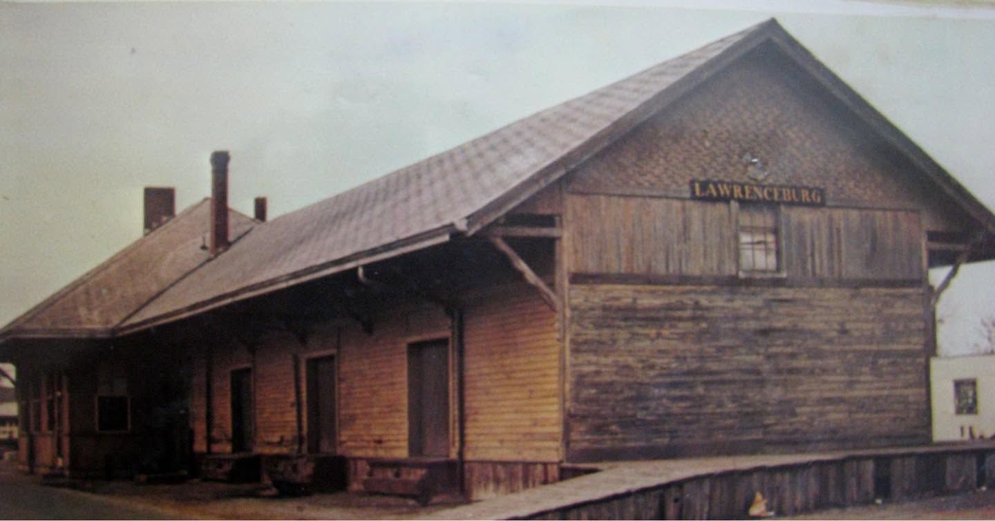
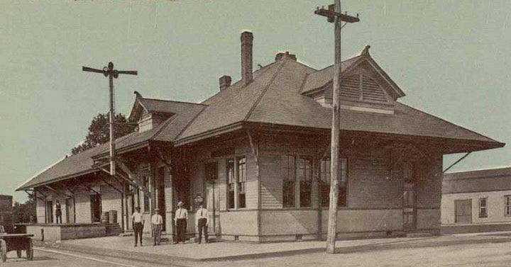
Lawrence County Votes to Build a Railroad
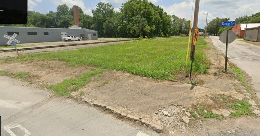
When There Was a Depot on Depot Street
Lawrenceburg’s Oldest Buildings: The Kerr Hotel
TN.41
Discuss the impact of the yellow fever epidemic on Memphis.
TN.42
Describe the events that led to the Coal Creek Wars in Anderson and the surrounding counties over the state of Tennessee’s decision to replace coal miners with prisoners.
TN.43
Describe Tennessee’s Centennial Exposition, and explain its significance.
TN.44
Analyze the effect of Jim Crow laws on Tennessee, and identify the efforts of advocates for African Americans, including the significance of: W.E.B. Du Bois, James Napier, and Mary Church Terrell.
The Rebirth of West Gaines School
Watch Night in Lawrenceburg
The Lynching of Bull Williams
TN.45
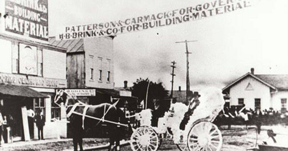
Summarize the influence of and reactions to the temperance movement in Tennessee, including the murder of Senator Edward Carmack.
A Drunk History of Lawrenceburg
TN.46
Describe Tennessee’s impact on the suffrage movement, including the following: “Perfect 36,” Harry Burn, Anne Dallas Dudley, and A.H. Roberts.
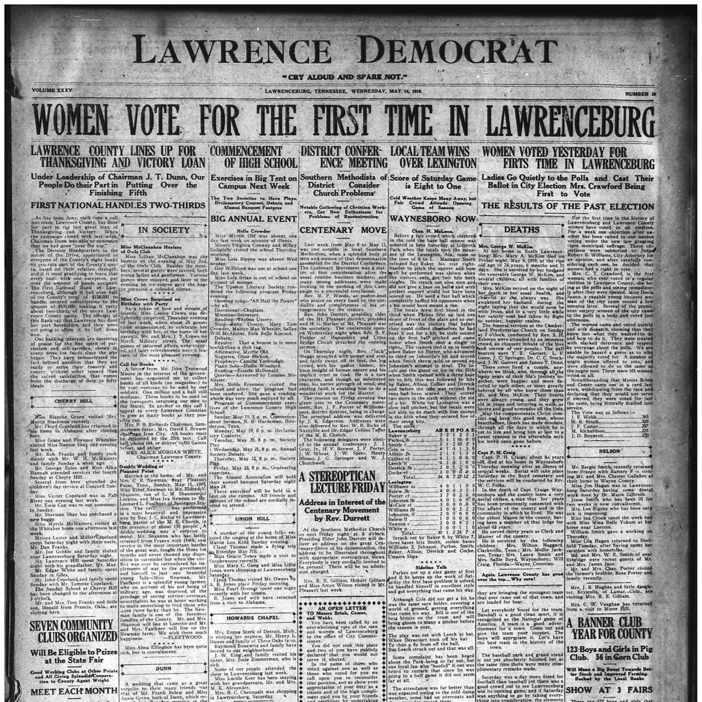
Lawrenceburg Gives Women the Vote
TN.47
Explain Tennessee’s connection to World War I, including the impact of Alvin C. York and the Alcoa plant.
General Pershing Takes Up for Local Boy
Battery F Comes Home to Lawrence County
Armistice Day in West Point
The Battle of Fairside Park: An Early Reenactment in Lawrenceburg
TN.48
Identify Governor Austin Peay and his influence on Tennessee’s infrastructure and education.
Labor of Love: The Birth of Lawrence County High School
The LCHS Bible Department
TN.49
Analyze how the Scopes Trial reflected societal tension between tradition and modernity.
TN.50
Describe major developments in country music (e.g., Grand Ole Opry, WSM, and the Carter family) and blues music (e.g., W.C. Handy and Bessie Smith) in Tennessee during this era.
A Christmas Classic First Published in Lawrenceburg
The Father of Southern Gospel Music
How the Democrat-Union Got Its Name
TN.51
Describe how the Great Depression and New Deal programs impacted Tennesseans, including the significance of: the Agricultural Adjustment Act, Civilian Conservation Corps, Tennessee Valley Authority, and Great Smoky Mountains National Park.
Lawrenceburg’s New Deal Post Office
Answering Reader Questions: Some Dam History
TN.52
Analyze the impact Tennessee innovators (e.g., David Crosthwait and Clarence Saunders) had on the nation.
Some Lawrence County Inventors
TN.53
Evaluate Tennessee’s contributions during World War II, including the impact of Camp Forrest, Camp Tyson, and Oak Ridge as well as the influence of Tennesseans during the war (e.g., Cornelia Fort and Cordell Hull).
Lawrence County Man Becomes First Tennessee Casualty of World War II
TN.54
Describe major agricultural shifts in Tennessee post-World War II and their impact economically and socially
The First Tractor in Lawrence County
Four Hogs For Every Person: Early Agriculture in Lawrence County
TN.55
Analyze the significance of key Tennesseans on both the state and national level during the 1950s and 1960s, including: Frank Clement, Ed Crump, Al Gore, Sr., Estes Kefauver, and John Seigenthaler.
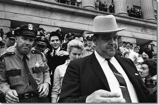
When the King Became a Colonel
Happy Birthday, David Crockett State Park!
The First Murray Bicycle Built in Lawrenceburg
TN.56
Describe Tennessee’s role in the Civil Rights Movement (e.g., sit-ins and Diane Nash, Highlander Folk School, Tent City Movement of Fayette County, Columbia Race Riots, and the Clinton Twelve). (T.C.A. § 49-6-1006)
The Integration of Lawrence County’s Schools
TN.57
Identify major Tennessee figures involved in the Civil Rights Movement (e.g., Rev. James Lawson, Kelly Miller Smith). (T.C.A. § 49-6-1006)
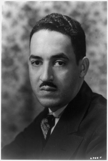
Thurgood Marshall Wins in Lawrenceburg
TN.58
Describe the purpose of Martin Luther King, Jr.’s presence in Memphis, the circumstances leading to his assassination, and the significance of the placement of the National Civil Rights Museum at the Lorraine Motel. (T.C.A. § 49-6-1006)
TN.59
Discuss the development of rock ‘n’ roll music in Tennessee and its impact on the changing American culture, including the significance of: Elvis Presley, Stax Records, and Sun Studio.
National Register Briefs: Crockett Theater
When the King Became a Colonel
TN.60
Describe cultural developments in Tennessee during the 1970s and 1980s, including: Country Music Hall of Fame, Music Row, Opryland, and the 1982 World’s Fair.
The Origins of the Middle Tennessee District Fair
TN.61
Identify the contributions of influential Tennesseans of the era, including: • Lamar Alexander • Alex Haley • Pat Summitt • Howard Baker • Dolly Parton • Fred Thompson • Al Gore, Jr. • Wilma Rudolph • Oprah Winfrey
Fred Thompson: Lawrenceburg’s Actor-Politician
TN.62
Identify major attractions and events that fuel the tourism industry in Tennessee, including the impact of: • Bristol Motor Speedway • Pigeon Forge (Gatlinburg) • Civil War sites • State and national parks • CMA Music Festival • Tennessee Aquarium • Graceland
Happy Birthday, David Crockett State Park!
How Lawrence County Became Amish Paradise
Going Old School…VERY Old School
Living on Amish Time
TN.63
Discuss the impact of major businesses in Tennessee, such as: • AutoZone • Nissan • Eastman • Toyota • FedEx • Volkswagen • HCA
The First Murray Bicycle Built in Lawrenceburg
TN.64
Describe significant and/or unique products from Tennessee (e.g., Cracker Barrel, Goo Goo Cluster, Moon Pie, Mountain Dew).
How the Democrat-Union Got Its Name