
That view has certainly changed!
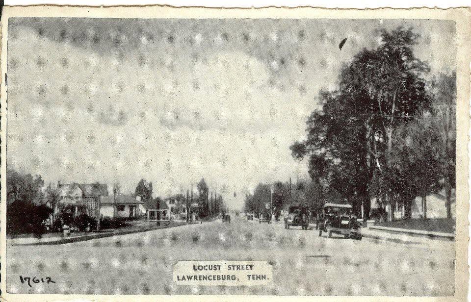
This undated view of Locust Street in Lawrenceburg looking north from the Pulaski Street intersection is part of the Old Jail Museum’s collection of more than 150 historic local postcards.
Although today Locust Street is the hub of much of the city’s commercial activity, this image captures a time when it was still relatively deserted, save for a few residential buildings.
The “longest red light in the world’ at Cyclone Corner is visible in the distance.
From Lawrenceburg’s founding to the mid-1930s, the main commercial center of town was the Public Square and North Military Street. That changed in the spring of 1934, when a new route was chosen for the Jackson Highway, or what we now know as Highway 43.
This massive infrastructure project was a fascinating–and successful–endeavor to rebuild Andrew Jackson’s original Military Road as a modern, paved highway between Nashville and New Orleans. There was only one problem for the people of Lawrence County: the state had decided to completely pass over the county’s historic business districts along the original Military Road in favor of a less-obstructed, more easterly course of Locust Street.
Despite a spirited protest by the businessmen of Lawrenceburg and Loretto to keep the highway running through the cities’ main streets–including at least one petition drive that netted over 200 signatures–the route of the massive new Jackson Highway was set for Locust Street in Lawrenceburg, and bypassed the business district of Loretto and the town of Ethridge completely. The reason? Railroad tracks.
In an effort to save money and create as unobstructed a pathway as possible for the new road, state highway officials set a course for the highway that completely avoided crossing the L&N railroad altogether.
The result was a harsh blow for downtown businesses in Lawrence County. While Military Street would continue to serve as the seat of local commerce for a few more years, that dominance rapidly and inevitably shifted to the new Jackson Highway.

Pingback: Bringing Local History to the Classroom | Lawrence County History Trivia